
NRCS Web Soil Survey Tutorial
This step-by-step tutorial can help you learn to use the USDA-NRCS Web Soil Survey.
Whether you're looking to build, farm, start a garden, or have any other reason to learn about your soil, the Web Soil Survey (WSS) has a huge amount of information on soils across the country, including yours. You may find it helpful to open the WSS in a new window or a different browser to view both the tutorial and the WSS on your monitor at the same time.
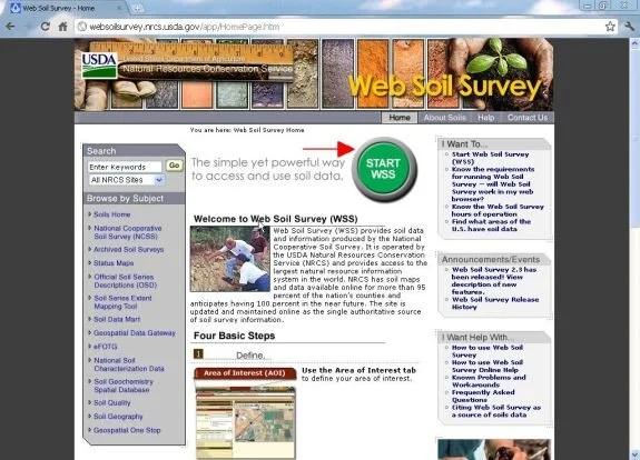
Step 1. Start Web Soil Survey (WSS)
To begin, go to http://websoilsurvey.nrcs.usda.gov. (This link will open the WSS in a new window so that you can view both the tutorial and the WSS on your monitor. You may also copy/paste this link into a new window or browser.) Click on Start WSS (green button) to start the WSS program.
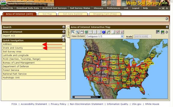
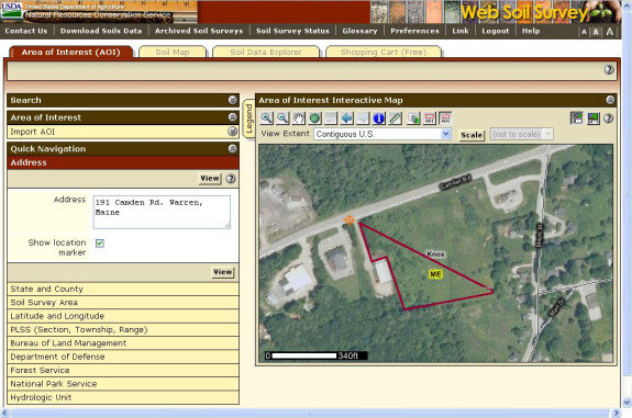
Step 2. Locate your Area of Interest (AOI)
We’ll use the Address or State and County tab in the Quick Navigation menu to search for the area we want. In this example, we’ll use the former Knox-Lincoln Soil & Water Conservation District office at 191 Camden Rd in Warren, Maine. Click on the Address or State and County tab and enter the address of your area of interest (AOI).
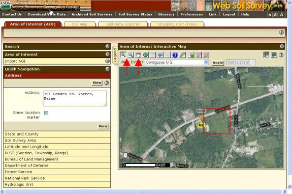
Next, use the Zoom and Move tools on the Area of Interest Interactive Map to zoom in on your AOI. For this example, we’ll use the field highlighted in red.
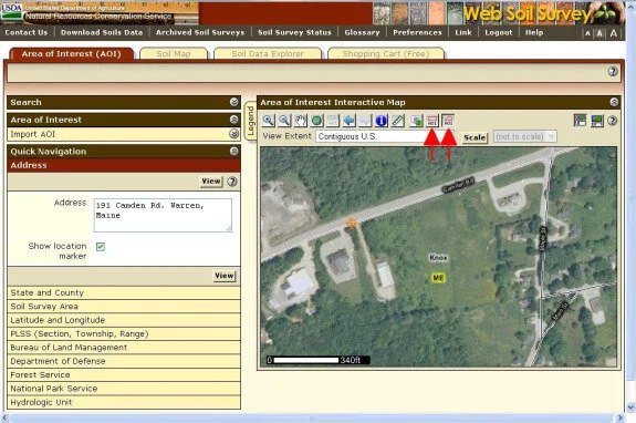
Step 3. Define your area of interest (AOI)
Now that you’ve zoomed in, use the AOI rectangle or polygon tools to draw your AOI.
To draw an outline of your AOI:
Polygon tool: Click on map for starting point. With mouse button depresssed, drag line to next points, clicking once on the map for each point that defines the perimeter.
Rectangle tool: Click on map for starting point, e.g., in upper left corner of rectangle. With mouse button depressed, drag mouse to lower right corner to define rectangle.
Double click at last point to finish map.
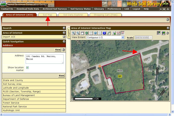
Now click the Soil Map tab to generate a soil map of the AOI.

Step 4. View and interpret the Soil Map
The WSS generates a soil map for your AOI. In the left column, under Map Unit Legend, the various soil series (types of soils) found in the AOI are listed. Each soil series has a Map Unit Symbol that corresponds with an area outlined on the map. Click on the Map Unit Name of each soil series for a description.

Step 5. Find specific information using Soil Data Explorer
For this step, we'll click on Soil Data Explorer to explore the soils in more detail.

There are four types of data available for each soil series, plus a short Intro to Soils. Click on each of these tabs for the following information:
Suitabilities and Limitations for Use contains information about suitability for building, disaster recovery planning, land classification, military operations, and vegetative productivity.
Soil Properties and Qualities contains data about the chemical and physical properties of the soil.
Ecological Site Assessment contains ecological information about Rangeland or Forestland.
Soil Reports contains reports on various topics. Soil reports provide a broader overview of information, whereas the information in the other categories is usually more detailed and specific.
Also, note the View Soil Information by Use bar, which can help you select relevant information by choosing land use. You can choose from Cropland, Forestland, Hayland/Pastureland, Recreation, Horticulture, Recreation, and Urban Uses.

Step 6. Generate a Soil Report
The WSS generates soil reports that you may download and save or print. First, click Soil Reports in the navigation bar above the soil map. Now choose the report that you want to generate from the Soil Report menu on the left. For this example, we want to know if it's a good idea to build on this site, so we will click the open button for the Building Site Development tab.

The View Description button generates an explanation of what's included in the report. Click on View Soil Report.

The report contains information about the suitability of each soil in your AOI for the construction of Dwellings and Small Commercial Buildings, as well as an assessment of each. In this case, suitability for building small buildings is "Very limited" for each soil in our AOI.
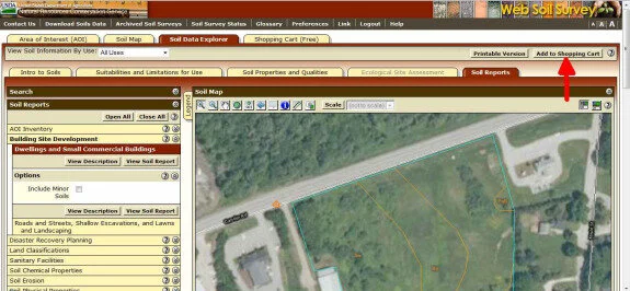
Click on Add to Shopping Cart to add the report to your free, final, printable soil report.
Step 7. Use the shopping cart to generate a printable soils report
Finally, the Shopping Cart generates a free report that includes the soil series descriptions in your AOI and whatever additional data or reports from Soil Data Explorer you choose.
Select the documents you want included, and click the Check Out button. Follow the instructions to receive the report by email.
That completes this tutorial. I hope that these instructions will help you easily access the huge amount of useful data contained in the USDA-NRCS Web Soil Survey.
Tutorial developed by Daniel Goettel, Soil Scientist